Limited Localization Spatial Guidance
Data recorded that 35% of users were failing to localize and timing out while their device was in a state of limited localization near VPS activated locations in Pokémon Playgrounds. The existing UI at the time only showed users a 2D hint image of the landmark they needed to point their phone at, but provided no additional guidance on where in the real world they were most likely to successfully localize. I first built a data collection prototype and conducted a thorough investigation at several VPS locations in and around the city to better understand the nature of the errors occurring in this state and to inform our designs. This work also included my own independent data analysis of error patterns and trends.
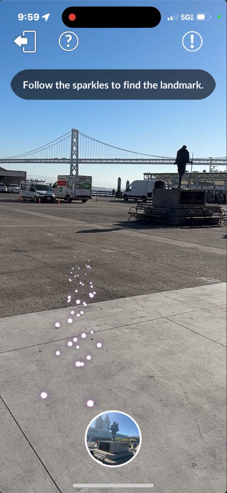
I conceived of, prototyped, and helped build the final implementation of the ego-centric spatial design you see in this video. It was intended to always emit forward from the user's perspective even if the target was directly behind them, and playfully (matching the game's visual style) lead them to the spot in the real world where their phone is most likely to initiate the full AR experience. User failures while in this state dropped to 8% after this feature was implemented.
Limited Localization Spatial Guidance
Ground UX
Data recorded over 12% of users were failing to localize and timing out due to their phones being pointed at the ground. I proposed that while the user is attempting to localize, we use the phone's sensors to detect if its forward pitch is beyond a certain threshold. If so, animate the hint image upward and to full screen, instructing the user to look up and around for the landmark. When the user tilts their phone back up, the full screen UI animates back to the default state - maximizing screen space for the AR experience. I built a prototype to iterate on and refine the tilt thresholds and heuristics which provided the final engineering specs. User failure rate after this feature was implemented dropped to 4%.
Ground UX